![](https://crystalpeak.com/wp-content/uploads/2024/02/crystal-peak-drone-blog-header.jpg)
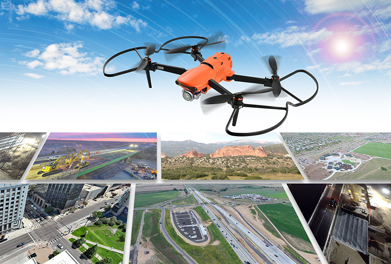
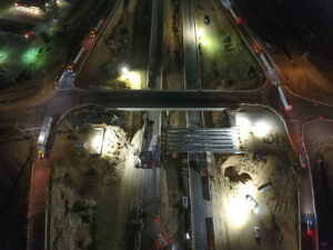
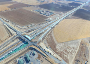
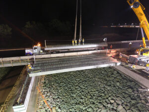
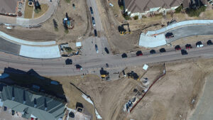
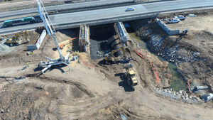
After providing drone imaging services for several years, Crystal Peak is pleased to offer upgraded 6K resolution imaging for its clients.
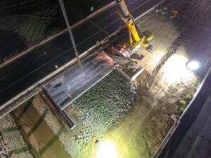
We have invested in a new and improved Autel Evo drone delivering 6K Ultra HD quality video, which provides superior image quality, adaptability and versatility for every lighting environment, retention of rich details in shadow and highlights allowing for greater flexibility in post-production, and features for improved shooting in low-light nighttime conditions.
This improved drone model also boasts an increased transmission radius and longer flight times to allow pilots to fly and capture your shots with greater efficiency.
![aerial view of Briargate Park near Union Boulevard in Colorado Springs](https://crystalpeak.com/wp-content/uploads/2024/02/briargate-park-drone-aerial-300x170.jpg)
![daytime view looking west of Garden of the Gods and Pikes Peak in Colorado Springs](https://crystalpeak.com/wp-content/uploads/2024/02/garden-of-godsk-drone-aerial-300x169.jpg)
![aerial drone shot of the Shafer Group CPA office building](https://crystalpeak.com/wp-content/uploads/2024/02/Shafer-aerial-shot-300x172.jpg)
![sunset view over Crystal Peak](https://crystalpeak.com/wp-content/uploads/2024/02/Crystal-Peak-Sunset_1_sm-adj-300x169.jpg)
![demolition of South Academy Boulevard bridge at sunrise](https://crystalpeak.com/wp-content/uploads/2023/10/SAB-Bridge-Demo-Sunrise-sm-300x225.jpg)
![drone aerial image of Larimer County Road 16 roundabout at Interstate 25 in Larimer County Colorado](https://crystalpeak.com/wp-content/uploads/2023/07/LCR-16-roundabout-300x200.jpg)
![drone aerial image of interstate highway bridge demolition at night](https://crystalpeak.com/wp-content/uploads/2022/03/Aerial-view-I25-CO60-SB-girder-erect_sm-300x225.jpg)
![drone aerial photo of interstate 25 interchange at Johnstown Colorado looking southeast](https://crystalpeak.com/wp-content/uploads/2022/03/CO-60-to-CO-56-Aerial-Photo_sm-300x213.jpg)
![drone aerial photo of interstate bridge construction setting girders at night](https://crystalpeak.com/wp-content/uploads/2022/03/MAX_0046_modified_sm-300x225.jpg)
![drone aerial image of intersection of Struthers Road at Gleneagle](https://crystalpeak.com/wp-content/uploads/2022/03/Struther_Gleneagle_Intersection-300x169.jpg)
![drone aerial image of I-25 bridge construction over Little Thompson River](https://crystalpeak.com/wp-content/uploads/2022/03/Little_Thompson_Bridge_Drone_sm-300x169.jpg)
![drone aerial image of I-25 bridge construction over Little Thompson River](https://crystalpeak.com/wp-content/uploads/2022/03/MAX_0066_modified_sm-300x225.jpg)
![sunset view over Crystal Peak](https://crystalpeak.com/wp-content/uploads/2022/03/Crystal-Peak-Sunset_1_sm-300x169.jpg)
When you work with Crystal Peak, you can rest assured that their drone is registered with the FAA and their pilot, Susanne Arens, has her FAA Remote Pilot certificate. Every two years, Susanne re-tests to keep her drone pilot’s certificate current. This ensures that she’s up-to-date on the latest laws, regulations and continues to hone her skills in drone imaging.